|
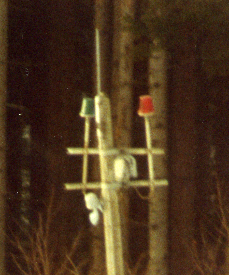
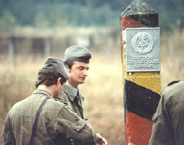
The border trace between the two
German states in the 2/11 ACR sector ran along
the old German boundaries between the former
principalities of Bavaria and Prussia until the
very northern end of sector. Here, the border
states changed to Hesse and Prussia. The Kingdom
Stones, as they were called, were very visible,
usually painted blue on the Bavaria side, this
was the state distinctive color. In the northern
reach of our sector, the stones were marked with
yellow on the Hessian side. Deeply carved in
these markers were the initials of the states,
KB, Kingdom Bavaria and KP, Kingdom Prussia.
|
|||||||||||||||||||||||||||||||||||||||||||||||||||||||||||||||||||||||||||||
|
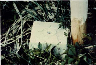
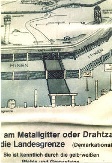
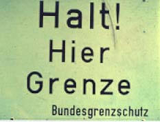
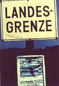
There was an amazing array of
signage and visual indicators associated with
the border, almost all of which were designed to
keep West German civilians and US military
personnel from accidentally crossing into the
east. Most signs were found along West German
public roads running directly to the border and
at vantage points look into the DDR that were
popular with West German tourists. Over the
years, the design and language of the signs
became minor points of contention between East
and West. Early signs noted East Germany as the
"Soviet Occupied Zone ", as these signs were
replaced, the language became less political.
|
|||||||||||||||||||||||||||||||||||||||||||||||||||||||||||||||||||||||||||||
|
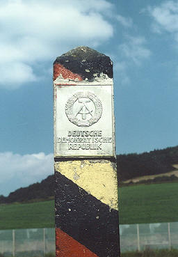
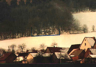
The DDR [East Germany] as if to enforce the notion of national sovereignty, placed these concrete markers with aluminum crests of the national seal all along the border, back from the actual line by about two meters. Clearly visible but just out of reach, they were placed even in the deep woods or swamps.
Needless to say, the national seal would have made a great souvenir. Within our sector, I can recall one marker, in the woods and otherwise not apparently under direct observation of the east, where the seal had been pried out with great effort. Apparently, the back of the
plaque had two very large bolts welded on that
ran several inches into the concrete. |
|||||||||||||||||||||||||||||||||||||||||||||||||||||||||||||||||||||||||||||
|
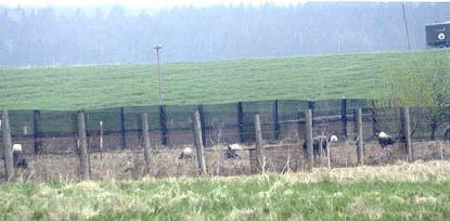
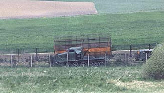
The actual East German barrier system was built six to ten meters inside of the DDR. This allowed the Border Troops to come through the fence gates for maintenance and still be on East German soil. This small strip of land between the barrier and the actual border line was known as the margin strip. The East Germans routinely cut back vegetation, conducted maintenance and worked on fence upgrades from the margin area. When fence construction was underway, the elite East German GAKs heavily patrolled along the margin strip.
|
|||||||||||||||||||||||||||||||||||||||||||||||||||||||||||||||||||||||||||||
|
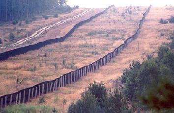
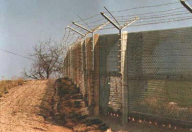
The first generation was simple barbed wire strung along wooden then concrete poles. As the barrier evolved, the amount of wire increased.
The second generation showed the
early evolution of the deep barrier system with
towers, Hinterland fence, bunkers and land
mines. The actual barrier fence consisted of
parallel fences of wire on concrete posts with a
mined strip between them. As of 1978, about 35%
of the Eaglehorse sector was still "second
generation".
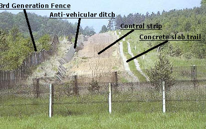
The third generation fence was a single barrier with land mines removed. The vast improvements in other security measures allowed the single fence method. The land mines were removed for a number of reasons; they were difficult to maintain and not fully reliable. The third generation fence carried anti-personnel mines on the eastern side of the fence. They were fused to go off on command or if the fence was touched. The photos show the evolution of the barrier system
There was near constant activity
by Border Troop engineers and civilian
contractors to make the system more secure. The
third generation barrier fence was a single
fence carried by concrete posts. The fence was
about 3.2 meters high. The actual fence seemed
to be die cut from sheet material rather than a
woven wire pattern. This made it very strong and
almost impossible to cut with wire or bolt
cutters. This pattern also made it almost
impossible find hand or foot holds to assist in
climbing. |
|||||||||||||||||||||||||||||||||||||||||||||||||||||||||||||||||||||||||||||
|
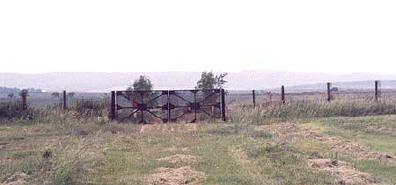
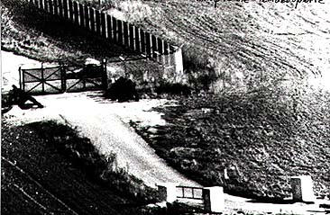
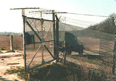
Along the barrier fence, gates had been built to allow access to the margin zone. Some gates corresponded to where previously existing roads once ran. Others were built at where Border Troop engineers felt necessary.
|
|||||||||||||||||||||||||||||||||||||||||||||||||||||||||||||||||||||||||||||
|
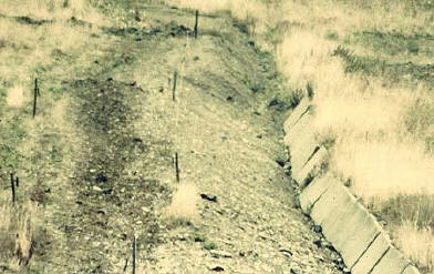
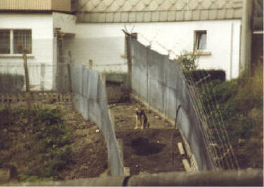
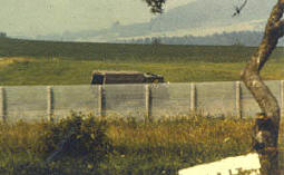
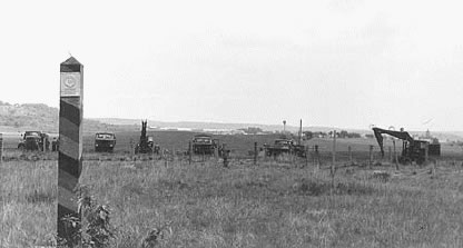
The anti-vehicle ditch was designed to keep vehicles from trying to crash through the barrier fence system. Located between the plowed control strip and the barrier fence, it featured a deeply dug ditch, sloping gently towards the border. Opposite the slope were a series of pre-cast concrete slabs set at about a seventy degree angle. If a car attempted to crash through the barrier system, first it would be slowed by the soft soil of the plowed strip, then trapped in the anti-vehicle ditch. In this photo, one can see the construction of the ditch as the Border Troops continuously worked to improve security. The ditch has been dug and a group of slabs placed. Survey markers will guide the creation of the plowed strip and patrol road.
|
|||||||||||||||||||||||||||||||||||||||||||||||||||||||||||||||||||||||||||||
|
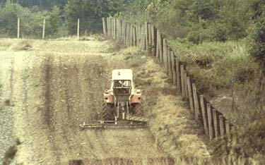
The control strip featured deeply plowed soil that would slow any car trying to crash through the border fence going from East to West as well as indicate the footprints of unauthorized personnel. As shown here, the strip was constantly maintained. As the border barrier first began to evolve in the 1950s and early 1960s, these soft soil strips were one of the first features employed by the East Germans.
|
|||||||||||||||||||||||||||||||||||||||||||||||||||||||||||||||||||||||||||||
|
The concrete slab trail consisted of precast concrete pads laid in the soil to create the patrol road used by the East German Border Troop, foot and light vehicle patrols.
|
|||||||||||||||||||||||||||||||||||||||||||||||||||||||||||||||||||||||||||||
|
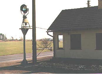
Within our sector, the only major external lighting by the East Germans was at Eussenhaussen . The legal crossing point on highway 19 was heavily illuminated both on the road and for several hundred meters to the left and right of the crossing check point. In the photo, we are looking through the fence into East Germany.
|
|||||||||||||||||||||||||||||||||||||||||||||||||||||||||||||||||||||||||||||
|
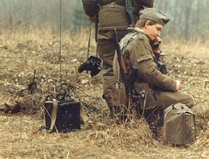
All of the towers and bunkers in the barrier system were wired into a telephone system. In many ways this was more reliable, less expensive and more secure than FM radio. Along the control road, at periodic intervals were telephone jack points through which a patrol could establish contact. The Border Troops carried a special phone on their belt for this purpose
|
|||||||||||||||||||||||||||||||||||||||||||||||||||||||||||||||||||||||||||||
|
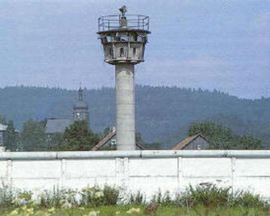
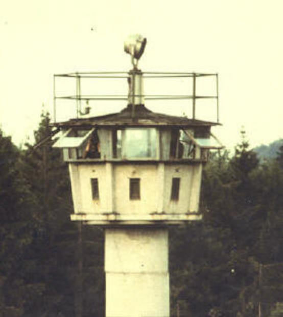
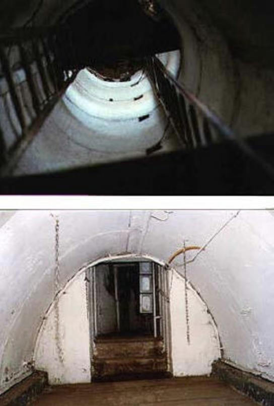
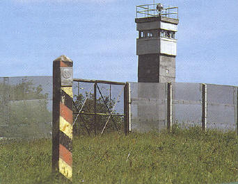
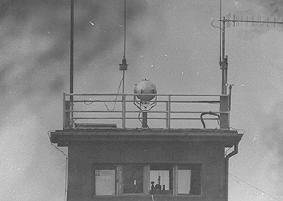
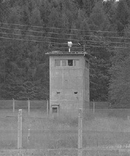
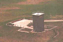
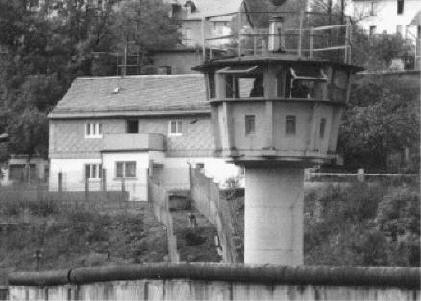
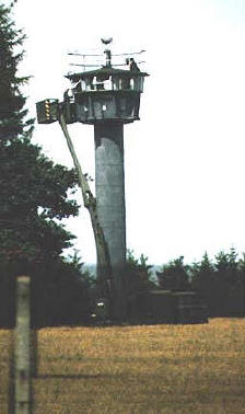
The round observation towers represented the second generation of observation towers placed along the border. They replaced the wood frame and steel frame towers that were built when the barrier system first began. The round towers were constructed of modular concrete sections, brought in on flat bed trucks and assembled with the help of a large crane. It took only a few days to set a new tower in place, however, the minimal site preparation led, on occasion, to disaster with more than one toppling in high winds. The towers were linked together and to the command tower by a hard line telephone system. A white light search light was placed on the roof but could be aimed from inside. In general, towers were placed to insure that a high level of visible control could be maintained over the barrier system. If the terrain would not allow this, blind spots were covered by bunkers, dog runs and remote sensing systems. To avoid creating a pattern, not every tower was staffed every day. Rather, within a give East German sector, the daily patrol and observation plan was varied.
Erwin Ritter had the chance to closely study the tower system after the border opened. Shown here are details of a second generation round tower from our sector that had a command bunker located at it's base. Note the heavy doors and concrete parking pad next to the entrance.
|
|||||||||||||||||||||||||||||||||||||||||||||||||||||||||||||||||||||||||||||
|
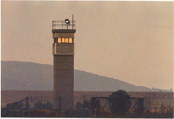
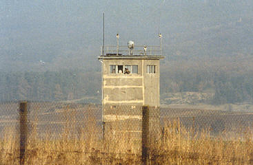
Although also built of modular sections, this new generation was larger, heavier and more care was taken to insure they were built on a firm footing. Construction could take up to two weeks depending on the specific location. Access to the roof was gained by a hatch, communication and overall living conditions were improved. When they first appeared in the 2/11 sector, these towers seemed to be filling in gaps in the visual coverage; as time and funds allowed, perhaps the plan may have been to actually replace the round towers although this would have been expensive.
|
|||||||||||||||||||||||||||||||||||||||||||||||||||||||||||||||||||||||||||||
|
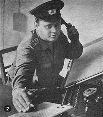
As noted, the Border Troops divided the responsibility for their patrolling and control of the border into regiment -- then battalion -- and finally company areas of responsibility. Not all towers were manned at all times to avoid creating a pattern, however, through the tower and bunker system assisted by vehicle and foot patrols, dog runs and remote sensors plus air coverage, a very tight control was maintained. The command towers, shorter and wider than the standard observation towers were manned at all times and were the control center of each border company in their security efforts. Some were closer to the actual border trace than others; they maintained a full array of both land line and fm communications plus the ability to react and marshal forces as necessary should a potential escape to the West be detected.
|
|||||||||||||||||||||||||||||||||||||||||||||||||||||||||||||||||||||||||||||
|
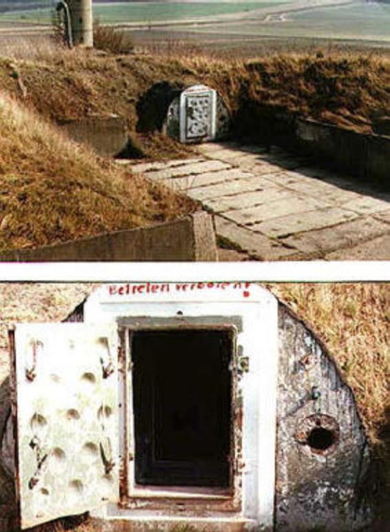
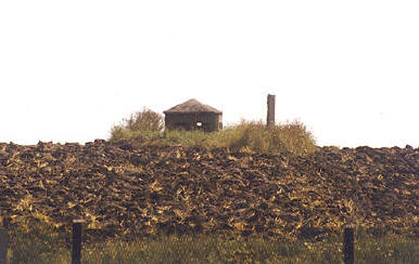
There were certainly more towers in our sector than bunkers. I can only remember three or four locations with any certainty and they were staffed only periodically. There was a joke it was more of a punishment to the troops than an actual method to control the border. Nevertheless, bunkers were another option for the East German border troop commander. They appeared to have a fairly large underground space, based on the air vent pipes seen in the photos. After the border opened, it was learned that several additional bunkers were located at controlling points associated with the Eussenhausen Crossing Point.
|
|||||||||||||||||||||||||||||||||||||||||||||||||||||||||||||||||||||||||||||
|
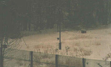
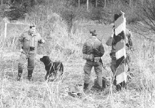
The dog on leash and cable system was a "point" defense / alert mechanism. The dog is tethered to a leash, the leash is then attached by a truck to the overhead wire that represented the limit of the dog run. This wire can only be suspended at the ends; anything intermediate would block the travel of the " truck ". At best, a 20 meter run before the sag effect of the overhead cable would set in. We had a few of these in the Eaglehorse sector. The East Germans provided a dog house to allow the animal an escape from the weather. In our sector, dog runs were seen but were not a key part of the security system. It appears as though they were used in areas outside the normal field of view from the towers. If a stranger approached, the barking of the dog would alert the guards. A dog "runway" is a narrow, fenced on both sides, long course in which the dog is otherwise free to roam and bark. This is more of an "area" alert mechanism because the runway can be much longer than a wire run. In a runway, however, the dog can only alert by barking, the dog on tether system actually allowed for the possibility of an intercept if one tried to cross in his small area. The "dog runways" in our sector were located deep in the security zone, well back from the actual border. In other parts along the dividing line in Germany, dog runways were integrated into the barrier plan much closer to the actual border. The border system used thousands of trained dogs, both for sentry work with a handler or alone on runs and run ways. The trained position of Dog Handler was highly sought after by the Border Troops. When the border collapsed in 1990, there was much concern over the fate of these animals. Active adoption programs found civilian homes for the vast majority.
|
|||||||||||||||||||||||||||||||||||||||||||||||||||||||||||||||||||||||||||||
|
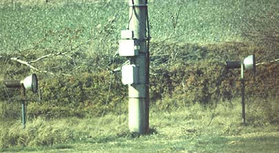
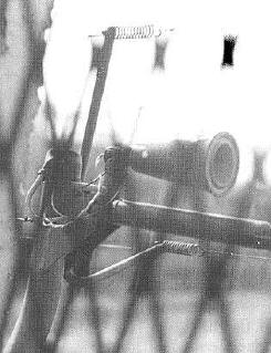
The Hinterland Fence, also called the Signal Fence, did not have land or fence mounted mines, but there were a variety of measures to alert Border Troops to any attempted crossing. The fence was wired with a variety of motion detecting sensors and trip wires. Some would signal silent alarms at the Border Troop command towers, others would trigger flashing warning lights and loud horns at the point where motion was detected.
|
|||||||||||||||||||||||||||||||||||||||||||||||||||||||||||||||||||||||||||||
|
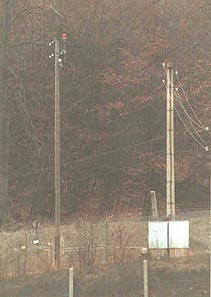
The Hinterland fence, control zone, Border Troop installations and barrier fence with high voltage lights and sensors all required a constant supply of electricity. The supporting power grid was built to insure that even in the harsh German winter, the supply would be uninterrupted, even at the expense of blacking out near by areas outside of the security zone.
|
|||||||||||||||||||||||||||||||||||||||||||||||||||||||||||||||||||||||||||||
|
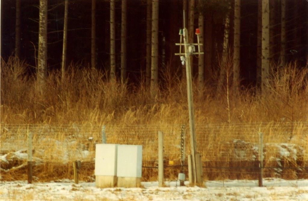
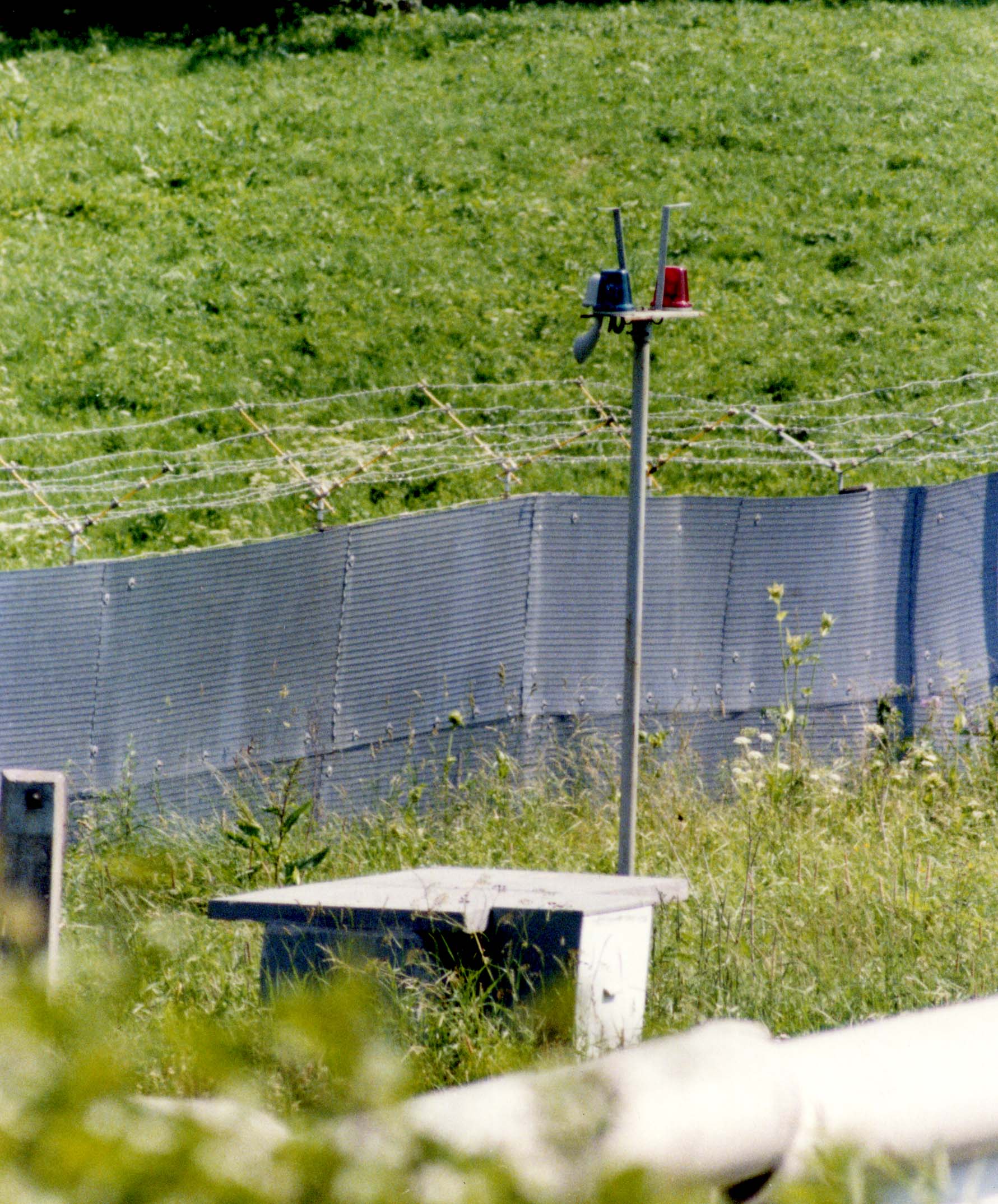
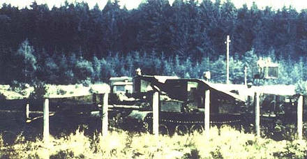
Entry points at the Hinterland fence were closely controlled. Seen here, an open automated barrier in the lower right of the photo, on a road leading to the Hinterland fence. The second photo is a detail of an actual entry gate at the Hinterland / Signal Fence.
|
|||||||||||||||||||||||||||||||||||||||||||||||||||||||||||||||||||||||||||||
|
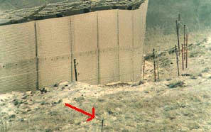
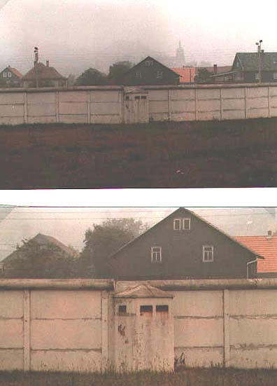
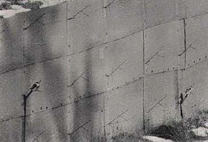
When either the Hinterland fence or the barrier fence passed through an East German town, rather than using the standard fence materials, a concrete wall reinforced with metal plates was used. This was because the town streets and population were more difficult to observe and control by the Border Troops. The wall was strong enough to withstand the impact of any civilian car or truck authorized in or near the security zone.
|
|||||||||||||||||||||||||||||||||||||||||||||||||||||||||||||||||||||||||||||
|
Before one would even see the "Hinterland" fence, road control points began to carefully monitor traffic heading into the border region. Anyone without correct credentials or a pass would be turned away. Once past this check point, monitoring continued to insure the stated destination was reached. The East German civil police, Volkspolizei, had responsibility for control of access leading to the Hinterland fence. Control points on the civil roads such as this one were located approximately five kilometers from the actual border. Passage was granted only to people either living in the Hinterland area or having specific business in the area. Once reaching the gates at Hinterland fence, the East German Border Troops would carefully check all traffic prior to allowing entry.
|
|||||||||||||||||||||||||||||||||||||||||||||||||||||||||||||||||||||||||||||
|
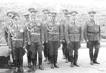
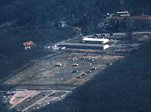
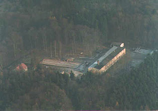
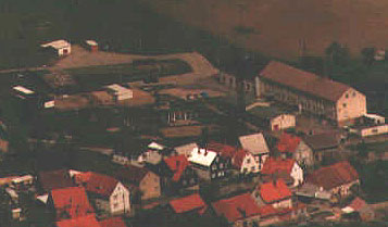
In the Eaglehorse border area, the East German barrier system was manned by personnel from two different border regiments. The northern and central portion of our area was staffed by Border Troops of the 2nd battalion, Grenzregiment 3, HQ located in the town of Kaltennordheim. This regiment carried the honor title of " Florian Geyer ". The southern portion of our sector was manned by Border Troops of Regiment 9, honor title " Konrad Blenkle ". Regimental HQ and the 3rd battalion were at Drachenberg Kaserne in Meiningen. The 3rd battalion, however, was responsible for the security at the Hinterland fence and the internal restricted area. The barrier fence in the southern zone was staffed by men of the 1st battalion, HQ in Roemhild, a small town very close to our southern patrol boundary. Typically, the line companies of the Border Troop battalions occupied their own separate barracks located inside the restricted zone in a village within their patrol area. The barracks consisted of billets for the soldiers, a motor pool and shop as well as an administration building. Married officers and higher level NCO's typically lived in private dwellings in or near the same village. Each company consisted of about 120 men at full strength, three regular platoons and the GAK (Grenzaufklarer) platoon. The GAK's were those Border Troops seen at close range, on the western side of the barrier fence, either providing security during construction or observing the West. The GAK's were the elite of the Border Troop units. Although half of the Border Troops were conscripts and had a high replacement rate as their tour of duty ended, the career soldiers, NCO's and officers provided a stable and well trained cadre. Much of their training was similar to the soldiers of the East German Army and in fact, they had heavy equipment to include tanks and artillery located outside of the border area. Border Troop regiments were part of a command subordinate to the Ministry of Defense but outside of the command structure of the Army. In the event of war, they had missions inside the border area extending into West Germany. The pay and benefits for the Border Troops was comparable to that given to members of the East Germany Army. Each pay grade had a salary rate, soldiers serving in technical or command positions received extra pay while serving in those capacities. Longevity in pay grade led to an increase. In 1980 East German Marks, a private in his second year of service would receive about 180 marks monthly. A mid level NCO, about 350. This same NCO, if serving as a squad leader could receive as much as a 100% increase. If on "career status" he could also be entitled to up to 38 days of leave. Small deductions were made for living in the barracks and for meals . Duty days were long and the six day work week common. Off duty time was restricted to the immediate area of the company barracks or nearby village. When not on actual border duty, there were normal military and security training events as well as mandatory organized sports. No civilian clothes were allowed for the junior enlisted men. Any attempt at contact with the West or possession of Western media was a highly punishable offense. Internal security in the barracks to include peer monitoring was stressed to insure anyone giving thought to an escape to the West was identified. Barracks friends were not assigned to the same duty patrols to prevent collusion. There were extensive training programs to include schools and academies for both NCO's and officers. Both political education and on going security training were stressed at all levels; it was a professional organization with a sworn honor code to protect the security of the East German state. In this capacity, they had " shoot to kill orders " to prevent escape from East Germany. During the history of the barrier fence system, nearly 1000 deaths due to gun fire, mines or injuries received while attempting to escape were recorded. After Germany reunified, a long legal battle led to indictments of senior Border Troop commanders as well as rank and file soldiers as the new government in Berlin struggled with the legacy of the barrier system. In certain cases, manslaughter convictions resulted with prision terms of up to ten years for the guilty. Within the Eaglehorse sector, the former regimental headquarters at Drachenberg in Meiningen is now a civilian police academy. Of the company size barracks scattered along the former trace, some have been redeveloped into low income housing, others partially converted to industrial space and some are vacant and in decay.
|
|||||||||||||||||||||||||||||||||||||||||||||||||||||||||||||||||||||||||||||
|
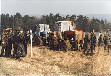
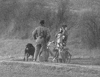
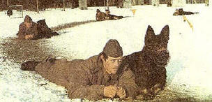
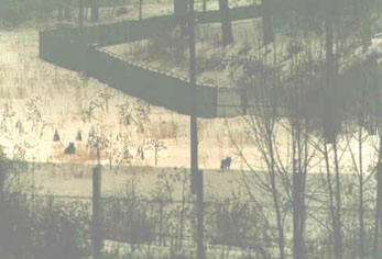
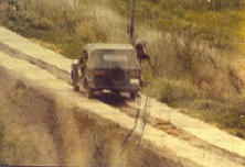
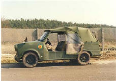
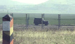
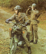
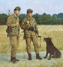
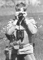
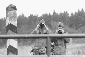
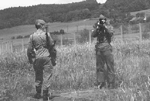
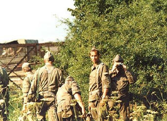
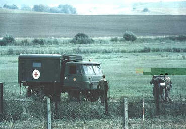
The companies of Border Troops, to secure the border barrier system, used a variety of mobile patrols. Often seen on the control road were any number of light wheel vehicles and trucks. Dismounted patrols carefully checking the plowed strip as well as motorcycle patrols were also common. These images, both of actual events seen on our border and scans from Border Troop manuals and recruiting brochures reflect typical scenes.
|
|
||||||||||||||||||||||||||||||||||||||||||||||||||||||||||||||||||||||||||||
|
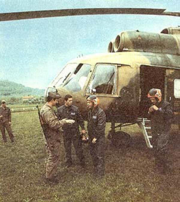
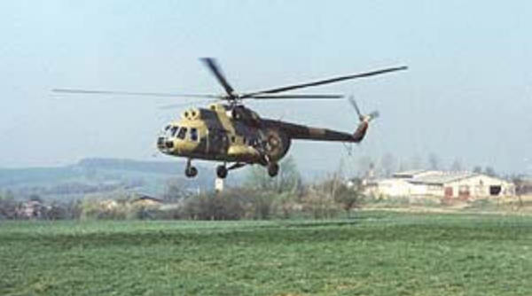
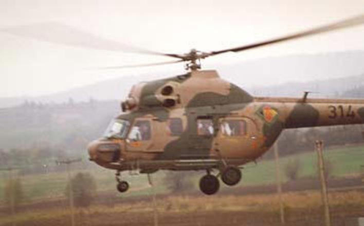
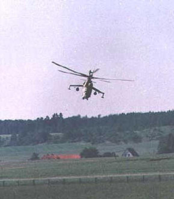
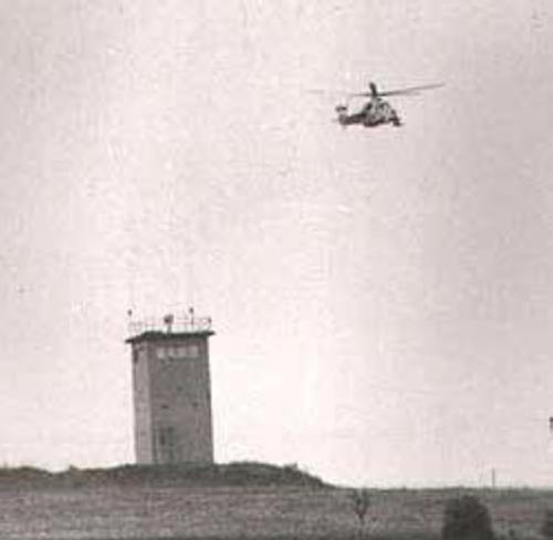
The East German Border Troops covered the barrier system from the air with military utility helicopters flying from an airfield near Meiningen. At least in the late 1970's, flights did not appear to be a daily occurrence and, in comparison to the Cav flights which hugged the actual border trace at low altitude and high speed, the East German flights were higher and somewhat back from the border. Normally seen were NATO named ' Hoplites ' and less frequently, the larger 'Hip'. Starting in the mid 1980's, even the very capable MI - 24 'Hind" was occasionally seen from the Eaglehorse sector. As the border opened but before the DDR collapsed, Erwin Ritter had the chance to get some close photographs.
|
|||||||||||||||||||||||||||||||||||||||||||||||||||||||||||||||||||||||||||||
|
The East Germans laid over 1.3 million anti
personnel mines along the border from 1961 until 1985. Their only
purpose was to prevent crossing from East to West. Along the border, to
include the Eaglehorse sector, the mines fell into two groups, the
buried land mines found between the two close running fence lines of
the second generation barrier system and the fence mounted " shot gun "
mines found on the single fence lines of the third generation barrier.
The ground laid mines, in wooden, plastic and steel
cases, were very unstable and prone to explosion in a quick thaw then
freeze, heavy rain or contact with wildlife. Working with these mines
was very dangerous and often, the mine pattern established by the
engineers was useless in the recovery process as the mines had shifted
position. The East Germans hung " Danger Mines " signs on the second
generation fences; these signs faced towards the West.
As the engineer troops of the border guard units
converted sections of the barrier system from second to third generation
fence, the buried land mines were recovered or, more often, detonated in
place, to clear the area for the construction of the new, single ply
fence. These operations were dangerous and carefully watched by the
GAK's of the DDR, the Bundesgrenzschutz of the Federal Republic and the
patrol members of the US cavalry. Even after reunification, the former
East German government admitted that it could not account for the
location of almost 18 ,000 mines, the vast majority were ground
mines. These mines were probably exploded but not recorded in recovery
operations or lost due to weather and animals.
Interestingly, as of 1985, the West German government
was offering financial aid to the DDR linked specifically to the
clearing of the ground mines. Even after the reunification of the two
Germanys with the great economic and technological assistance of the
former West Germany, it was not until late 1995 that the Federal
Government certified that the last areas of the former border region
were free of land mines. The final section cleared was by Hof, not too
far to the southeast of the Eaglehorse sector. In 1995 US dollars, the
final cost of clearing the border region in Germany of mines and
barriers was put at over 142 million. For more information on mines and
East German engineer troop activities, please see the " Engineer Troops
" tab.
|
|||||||||||||||||||||||||||||||||||||||||||||||||||||||||||||||||||||||||||||
|
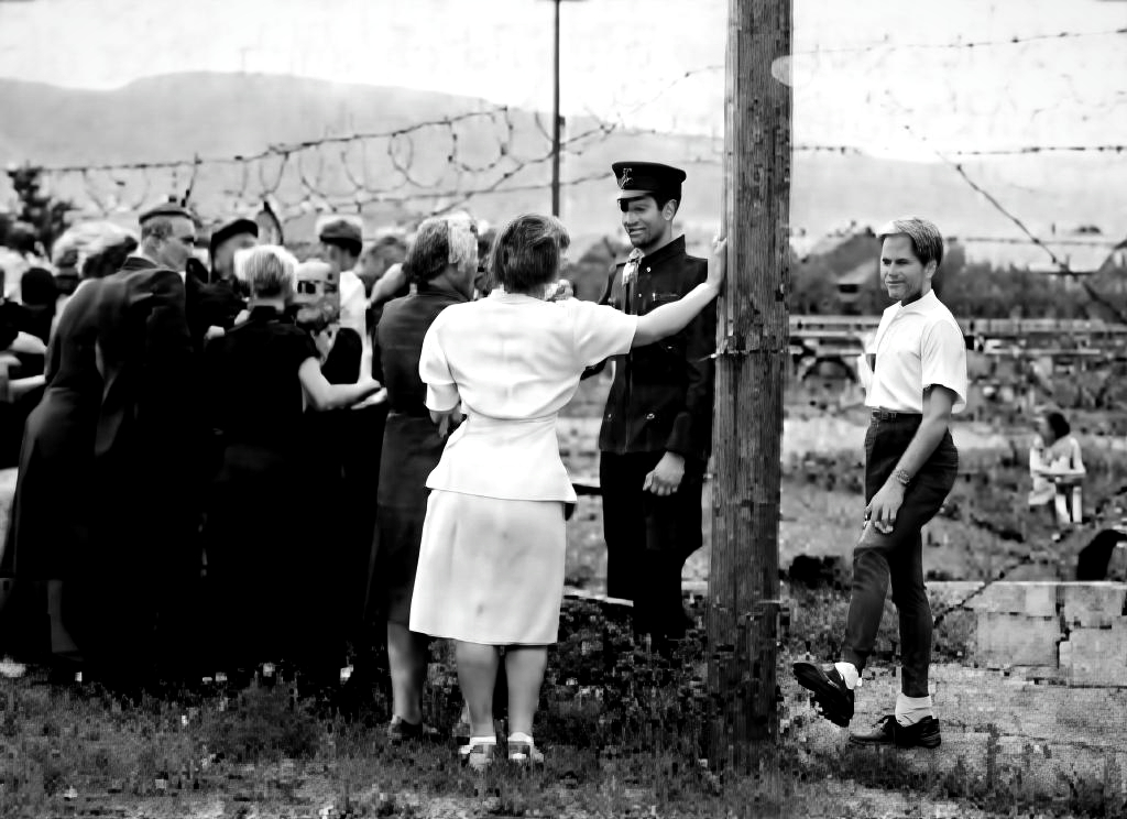
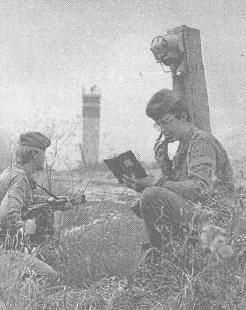
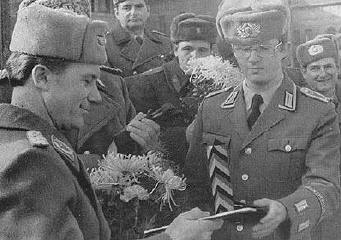
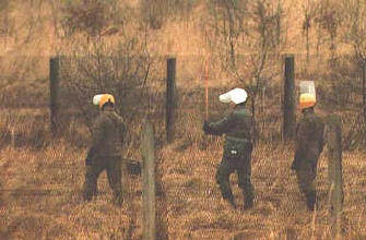
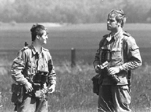
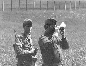
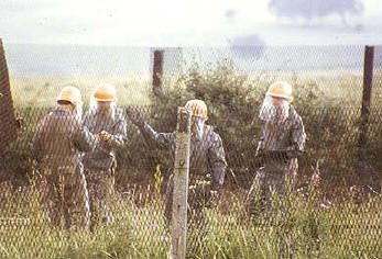
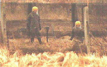
Although from the same Border Troop companies, there was a significant distinction between those BT's seen on the Eastern side of the fence, in the towers and on the roads, and those seen at close quarters on the Western side of the barrier ... usually providing security when the fence was being worked on. This latter groups, called GAK's (Grenze Aufklarers) (border reconnaissance) represented a specific sub set of the Border Troops. They had received additional training in security and reconnaissance skills and gone through a very carefully screening and selection process. They were considered the elite of the Border Troop ranks. Nevertheless, over the history of the inner German border, well over 100 of these specialized troops defected to the West. All photos courtesy of Erwin Ritter
|
|||||||||||||||||||||||||||||||||||||||||||||||||||||||||||||||||||||||||||||
|
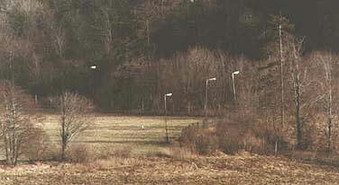
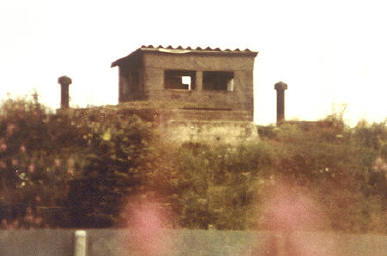
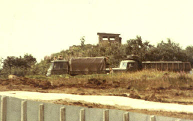
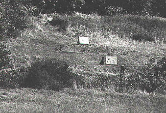
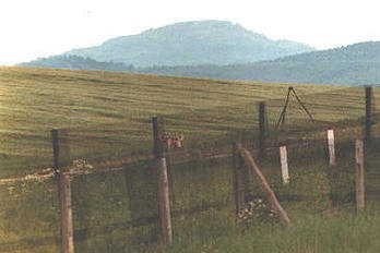
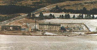
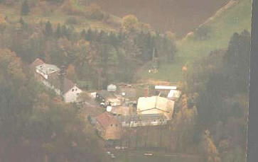
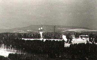
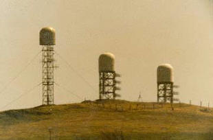
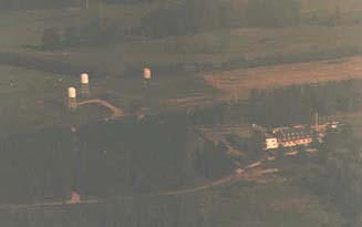
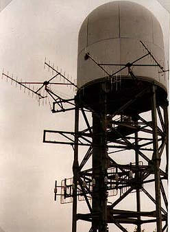
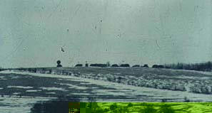
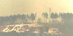
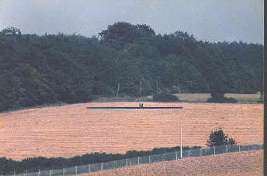
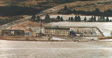
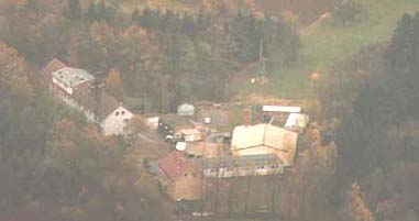
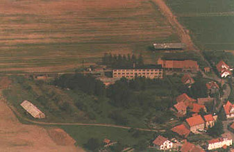
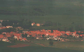
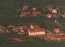
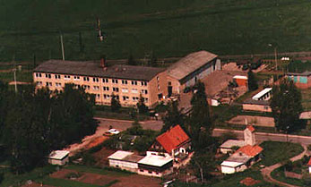
Both East and West saw the border as a rich area for signals intercept. Within the Eaglehorse sector, just visible to the naked eye was the " Bee Hive " antenna array by Ellenbogen. This was an East German state intelligence service signals intercept point. Featured are four fotos showing the Ellenbogen complex at various distances. Once the border opened and East Germany began to fall apart, Erwin Ritter drove to the site and took several close ups of the antennas. Also visible from the Eaglehorse sector was the Soviet Army radio intercept base at "Grosse Gleichberg", near the East German town of Rhomhild. This could be seen in the distance from the vicinity of Breitensee, in the southern portion of our responsibility. A standard US patrol area of concern were the temporary Soviet signals collection points established a few kilometers back from the barriers during periods of large NATO maneuvers. This image of Hill 805 shows just such a collection point. [All photos courtesy Erwin Ritter]
|
|||||||||||||||||||||||||||||||||||||||||||||||||||||||||||||||||||||||||||||
|
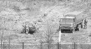
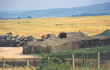
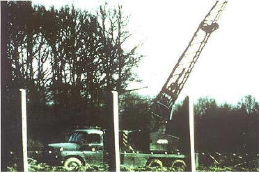
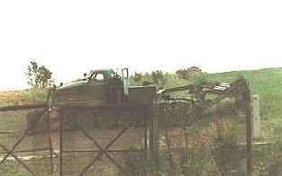
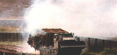
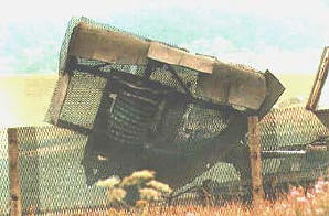
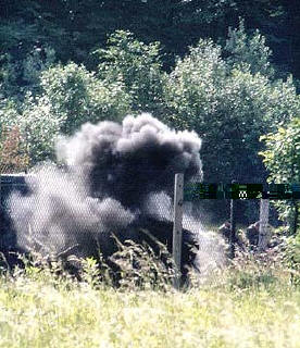
Also stationed in Meiningen in support of Grenzregiment 9 was a separate engineer company. They provided barrier related maintenance and construction support to include such tasks as third generation barrier transitions of both towers and fence systems. The barrier fence evolution from the parallel fences to the new style single fence was a simple enough procedure. The de- mining of the center strip posed many problems. The mines shifted in position due to frost heaves and erosion; they were not always stable. Although the smallest anti - personnel mines had been placed, recovery or detonation proved to be dangerous work for even highly trained soldiers. A variety of methods were used to include mine rollers and flails built on T54 chassis. On occasion, it was necessary for soldiers to search for mines with wooden or fiberglass poles. One tracked utility vehicle had a large screen built into the side to protect the engineers as they searched with long poles. At certain times, it was necessary for the soldiers to dismount and rely on the protection afforded by special body armor and head - face shields.
|
|||||||||||||||||||||||||||||||||||||||||||||||||||||||||||||||||||||||||||||
|
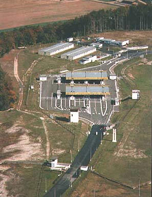
The DDR devoted enormous
resources to build, staff and upgrade the
border barrier system. There were, however, a
few legal crossing points; one of which was
located in the Eaglehorse sector, by the village
of Eussenhausen, just to the east of OP Sierra
/ OP Tennessee.
This border feature opened in 1972 where Highway
19 crossed into East Germany. Before 72, the road stopped at the
fence line. To allow trade goods to cross back and forth between
the nations behind the Iron Curtain and the West, road and rail
crossings needed to be developed. These were negotiated in the
early 1970's and opened in 1972. Other crossing points included one
at Coburg, to the south east in the 2nd ACR sector and Herleshausen
and Bebra elsewhere in the Blackhorse border area.
Travel from the DDR into West Germany was very
tightly controlled for private citizens. Access from the West was
somewhat more open. Eaglehorse troopers had no involvement in the
crossing point beyond casual observation from our OP. The West
German side was screened by members of the BGS and Federal Customs
Police. The East German side, with a full array of check points,
inspection points, towers, bunkers and barracks buildings, was
manned by their Customs Police and secured by members of a Border
Troop company.
Today, at the former crossing point, Highway 19
passes seamlessly through the area, just off to the sides, however,
many former East German buildings remain as relics.
|
|||||||||||||||||||||||||||||||||||||||||||||||||||||||||||||||||||||||||||||
|
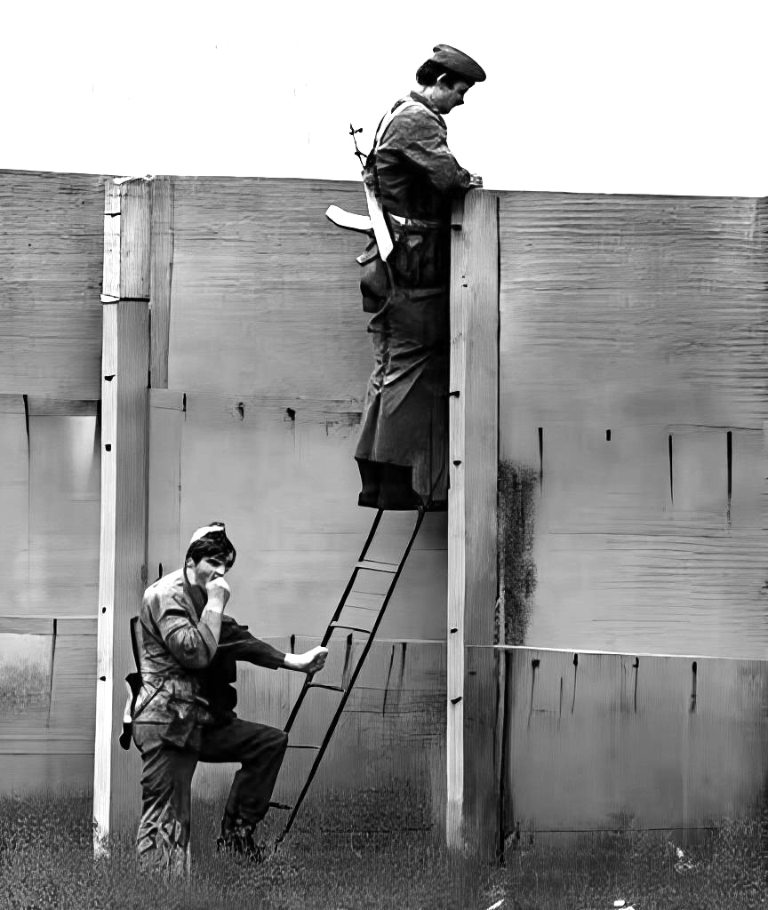
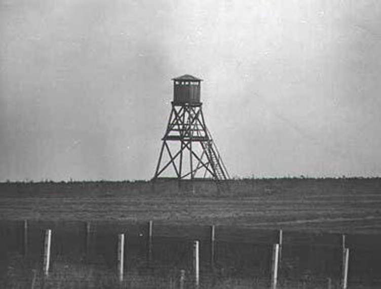
As the border evolved from a simple wire fence to a deeply echeloned barrier system, the East Germans began to add guard towers to more fully control the area. The first generation towers were built of wood. In the Eaglehorse sector, these had all been replaced by the second generation concrete towers by the early 1970's.
|
|||||||||||||||||||||||||||||||||||||||||||||||||||||||||||||||||||||||||||||
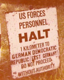
|
Rules and agreements
developed over the years help to partially
defuse potential flash points along the East -
West German border. Members of the US Army,
unless they were part of the border surveillance
mission, were prohibited from being within one
kilometer of the border. The Bundeswehr was
also prohibited from this region. In East
Germany, the Volks Armee, the regular military,
and the Soviet Army likewise were not allowed
into the 1 kilometer zone.
The Soviets maintained their own visual
observation system along the border region through a series of
bunkers almost always set behind the Hinterland / Signal fence.
They were located at points which could observe avenues of approach
across the border as well as other areas of interest in the border
area. Soviet troops from Meiningen, or higher levels of the Russian
command from the cities of Erfurt and Gera, would occupy select
bunkers during NATO / US maneuvers to observe.
The bunkers themselves were unremarkable,
however, they usually were located near a screening terrain feature
which could hide a parking area and support building. In the
Eaglehorse sector, Russian observation bunkers were located (from
North to South) by the towns of : Melpers, Schwickershausen and
Gompertshausen.
|
|||||||||||||||||||||||||||||||||||||||||||||||||||||||||||||||||||||||||||||
|
Border Troops as
Deployed Across Eaglehorse Area
As with most military organizations, units were
redesignated and locations changed as years passed; this occurred on
both sides of the border. Rather than tracing the complete history of
the Grenztruppen units, here is a snap shot of units deployed within the
Eaglehorse area of border responsibility from mid Summer1985 thru
September 1989. We would like to thank Erwin Ritter for providing this
information.
Border Regiment 3
With regimental headquarters in Dermbach, this unit
had border responsibility for much of the 1/11 ACR border area. Three
companies, however, part of the Second Battalion, had border
responsibility in our northern run of sector. Located in the towns of
Frankenheim, Erbenhausen and Stedtlingen were, respectively, Border
Company 6, 7 and 8. Most border guard units were located in small towns
very close to the trace in company size barracks. The compounds
consisted of the living space and administrative area, motor shop,
parking area and kennels if authorized. Of all border unit barracks
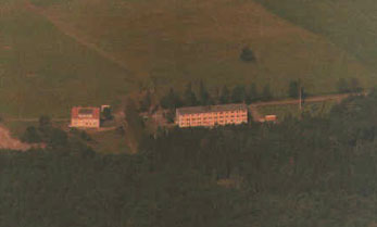
located in the Eaglehorse sector, the Frankenheim facility was by far
the most visible, seemingly only a few hundred meters into the DDR.
Border Regiment 9
In the central and southern sector, DDR Border Troop
responsibilities shifted to Regiment 9, Headquarters in Meiningen. The
First Battalion Headquarters was located in Romhild with an Engineer
Company. Four line companies, located in the following towns, patrolled
the central and " eastern " run extending past the Eussenhausen Crossing
Point: Company1-Schwickertshausen, Company 2 - Behrungen, Company
3-Mendenhausen and Company 4- Gompertshausen. Also at Schwickershausen
was the security platoon assigned to the l HWY 19 Crossing Point. The
personnel conducting vehicle inspections and staffing the East German
road control points at the legal crossing point came from a platoon
located in Meiningen. The East German Customs officers also were
located in Meiningen but not under Border Troop command.
The Third Battalion, located in Meiningen, had
responsibility for the rear security of the sector along the Signal
Fence and approaches. Company 10 was located in Hermannsfeld, easily
visible from OP Sierra / Tennessee and Company 11 was in Hindfeld.
After September 1989, border command responsibilities
were greatly rearranged but for the most part, the company size garrison
towns remain unchanged. As we have noted, in the years since
reunification, the former Border Troop barracks areas have found new
uses. Some are low income housing, others either in part or entirely
involved with industry and a few are abandoned or waiting redevelopment.
All photos courtesy Erwin Ritter
|
|||||||||||||||||||||||||||||||||||||||||||||||||||||||||||||||||||||||||||||